My mom was so upset by what she read in my Alta Alpina 8 report that she refused to finish reading it. The cyclists who've read it have been completely non-plussed. For mom's sake, I guess I'll tone down the suffering in the future accounts.
.

Friday, June 18, 2010
Monday, June 14, 2010
Alta Alpina 8-pass Challenge aka Death Ride x 1.6
OK, that was effin' epic...


Weather forecasts were favorable during the week preceding the ride, with the last one predicting temperatures in the mid 40s-mid 60s range. So far, so good. On Thursday afternoon, someone posted on Facebook that it may be windy during the ride, but believing that everybody talks about the weather and does nothing about it, I decided to hide my head in the sand and refused to check the forecast. One can prepare for temperature changes, but short of installing sails there's nothing to do about the wind.

I knew this would be a hard ride, with 20,000 feet of climbing, all of it at over 4,000 feet, with all eight mountain passes at over 7,300 feet. So, the ride plan was to ride to finish before the course closed at 10:00 p.m. and if things go well, finish in daylight. With a 3:30 a.m. ride start I wanted to get to bed early, so I turned in at 8:00 and fell asleep almost immediately.
Woke up before the alarm at 2:20 -- six hours of sleep, awesome! Breathing felt weird. Felt like I couldn't take a full, deep breath. Hoping it wasn't a sign of my inability to handle altitude, I decided to ignore it, wishing it to go away. Ignoring it seemed to work.
By my standards, I dressed lightly for a morning with temperatures in the high 30s. Decided to go with long-sleeve light merino base layer, wool arm warmers, long-sleeve jersey, vest, knee warmers, cap under the helmet, light long-fingered gloves, and toe warmers. Ate my usual pre-ride fare of two bananas and three egg whites, washed down with a bottle of Gatorade, loaded the car with everything I'd brought to give myself an option to drive home after the ride rather than spend the night, and took off for Turtle Rock Park where the ride began.
Parking lot was filling quickly. I arrived around 3:20 and riders were leaving already. I'd checked in on Friday night and had my number and wrist band, so all I needed to do was put on my shoes and helmet and start riding. I left exactly at 3:30.
As is my bad habit, I felt compelled to chase down a group that started half a minute ahead. I justified this by convincing myself that I would recoup the energy spent chasing this group by drafting them once I'd made contact. Pshaw! We all know how that works. I made contact and rode with them for a mile or two, then concluded that they were going to slow (too slow for what?!) and rode off alone in pursuit of the red blinky light that beckoned tantalizingly a hundred yards ahead.
A few miles later, I found myself between groups riding through Diamond Valley toward Kingsbury Grade. We were on a plateau, in complete darkness. I looked up at the stars a few times and they were magnificent. In search of better stargazing, I turned off my light for a look up, but the darkness scared me and I quickly turned the light back on. It would have made much more sense to go with a helmet-mounted light. I would have been able to see the computer and the route sheet, but my helmet light's battery wouldn't last as long as my bar-mounted light's, so I went with a bar light. As it was, I found myself following blinky lights, and this worked well enough.
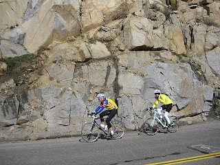
The blinkies all rode very casually, perfectly logical at 3:45 a.m. at the start of a 200-mile ride, and I kept passing them. After a while, I began to worry that there would be no blinkies to follow if I reached the head of the "race" and I didn't know the route and couldn't see my route sheet. I really needed to ride with someone who knew the roads or could read the directions without stopping. It was getting warmer, with temperatures reaching low 50s and I wondered if I overdressed. Finally, I caught a guy from Tahoe who knew the roads and was going at my speed. Actually, he was going a little faster than my speed, so I found myself going at his speed. Again, this was not optimal, but I needed to know where to go, so I stuck with him. We rode and talked for about 15 minutes until we reached the foot of Kingsbury Grade to Daggett Summit, a climb from hell, as far as I was concerned, that ended with a two mile stretch at 11-12%. I asked my companion how long the climb was, he said: "An hour. 55 minutes if you're fast. 50 if you're really fast." I told him I'd aim for 1:10 and let him go.
Kingsbury Grade

It was breezy and cold at the top. I got a sticker for reaching this pass. At each pass we would receive a sticker on our numbers as proof for completing each segment of the ride, with eight stickers at the end of the ride signifying completion of all the passes. I put the hat back on, refueled, greeted Jack Holmgren, an Oakland double century and randonneuring veteran, and took off. Half way down the mountain, saw Sean Smith climbing. I invented a praying mantis aero tuck. Actually, I borrowed it from Floyd Landis, ca. 2006, but made an important modification: Landis used aero bars for his position, I didn't have aero bars. I rested my forearms on the bars and raised my hands to deflect the air from my head and torso. Fast as hell. Unsafe? You bet. But with no turns requiring braking and excellent road surface, I cruised comfortably all the way back to the valley.

(photo credit: Brian Chun)
Luther Pass

Carson Pass
Jack arrived at the rest stop while I refilled the bottles. We grabbed a quick bite and left together. We tucked and zoomed back down Luther and at the bottom turned right into a tailwind toward Carson. It was a tailwind even though I tried to convince Jack that his high speed was the product of the excellent draft I provided him rather than the wind at our backs. Before the climb began in earnest, there were a couple of mild rollers about which Jack warned me. It was helpful to know that. As the other climbs so far, Carson was a relatively mild climb, with grades in the 4-6% range, made easier by the now howling tailwind and spectacular views. The wind was so strong that I felt it pushing me in the back. Normally, I don't feel the tailwind, only see its benefits on the computer, but this time I really felt that it was shoving me up the climb.
(photo credit: Brian Chun)
 With this wind at my back, it was easy to lead Jack up the climb. For the riders descending it was not so easy. The wind blew so hard that we could see them struggling the keep their bikes going straight and keep their speed up. We pressed on. Carson Pass sign came into view. I stopped to take a picture and put on my hat and gloves while Jack continued to the rest stop. He left before I finished my rest stop business.
Leaving the Carson rest stop proved that my impressions of what the wind had in store on the descent were accurate. I fought to keep the bike going straight, as gusts buffeted me and threw waves of sand at my face. Climbing Carson, I'd spied the magnificent Red Lake. Rather than spending a thousand words, on the way down I stopped to take a picture.
Blue Lakes
Blue Lakes didn't happen. Ride organizers warned us by e-mail that the road to the summit likely would be closed and they added an out and back trip down Airport Road outside Markleeville just before the lunch stop. The ride toward Blue Lakes, though, was very pleasant. It climbed gradually past still leafless aspen forests. As the road pitched up, I shifted into the small ring and promptly dropped my chain, which got stuck between the crank and the frame. Pulling it loose took some doing. I remounted and as I began to ride heard the chain rubbing unusually. Got off again. Discovered that my chain watcher gizmo traveled down the seat tube and was rubbing the chainrings and the chain. Took out the screwdriver and turned the gizmo 90 degrees to get it out the way. Fine screwdriving to get the chain watcher to work properly was beyond me at this point. Remounted again and continued. The climb ended unexpectedly, as I came to the rest stop just before a shut gate. Beyond the gate, the road was covered in snow. Bottles refilled and body refueled, I left the rest stop. A few minutes later, I greeted Sean who was climbing easily.As I hit the valley at the bottom of descent, I also hit headwinds. A rider (Andy Snyder) was ahead of me. I sped up to take advantage of his slipstream and we shared pacing through the valley and began the descent along West Fork of Carson River back toward Woodfords. On the descent, we caught another rider in a red jersey. Praying mantis re-emerged on the descent, as Andy dropped back. Red jersey and I took turns down the descent, but, honestly, with nearly 100 miles to go, I let him do most of the pulling. I didn't see a number on him and it looked like he was just out for a ride, so I felt no guilt wheelsucking. He said one point, "so you have Ebbets and Monitor left?" I said, "yes." "Long day," we agreed. But hearing/realizing that there were just two passes left, albeit each done twice, made it seem manageable.
We reached Woodfords and I turned right toward Markleeville, while red jersey went straight. It was getting warmer. Four miles down the road was the left turn onto Airport Road. It immediately kicked up at ~8%, which was the steepest hill of the day so far. That went on for a good quarter mile. Actually, it was not a good quarter mile, it was a bad quarter mile. I was dressed for the descent from the snowed over Blue Lakes Road and here I was bathing in sweat in 60+ degree temperatures. Off with the hat and gloves again. Reached the top, where the road was flat for fifty yards before plunging -- and I mean plunging -- down toward Markleeville Airport. As I descended, I saw Jack, Nicole, and a few other people I know climb out of the valley where the airport was. As I descended, I cursed ride organizers who sent us here because I didn't look forward to climbing out of this valley. But the bottom of the descent was where we received Blue Lakes stickers, so this was required riding. Got my sticker, grovelled up half a mile of what now was the steepest part of the ride, all the while cursing Alta Alpina Cycling Club for sending us here, then descended the quarter mile bit back toward Turtle Rock Park and lunch. Took off arm warmers and toe covers and left them in the car, optimistically believing I wouldn't need them anymore.
Sean arrived at the lunch stop at the same time. This was his 50th double century, earning enshrinement in California Triple Crown Hall of Fame. Congratulations!!!

(That's L for Roman 50!)
I was 113 miles into the ride, about 87 remained, and since it was just noon, I decided to take my time at lunch. I made myself a meaty sandwich, had a Coke and some salty snacks. Somewhat rested and refreshed, I was ready to get back to work. It was warm, but I decided to bring but not wear my hat and gloves for high altitude temperatures.

The road descended for two miles into Markleeville, then down to East Fork of Carson River Valley. I was riding upstream, but had a tailwind. With the grade and the wind canceling each other out, I was making good progress. East Fork of Carson was as gorgeous as the West, but wider and calmer. People were fishing and kayaking here. Clouds were long gone and temperatures in the valley were much higher than on passes, so off with my hat and gloves once again. This was pleasant and a bit tiring.
The climb of Ebbets began mildly and innocently enough, although there was one rather ominous sign. I mentally shrugged at it and continued undeterred.

(photo credit: Brian Chun)


As I stopped to receive sticker no. 5, I saw Robert Choi. Robert Choi, who often wins these rides, caught me at mile 130. Obviously, he started after me. I assumed he started at 5:30, the latest possible start time. I didn't feel so bad about him taking 130 miles to make up two hours on me. Later, I learned that he started at 7:30. I am not sure how I feel knowing that he made up four hours on me in 130 miles, though I am glad I didn't know it then. Robert and I got our stickers and began the descent to Hermit Valley rest stop to collect sticker no. 6. Holy cow, I can do a portion of the ride faster than Robert -- the descent. Well, by all means, I will put 10 seconds into Robert on the descent and he'll finish over two hours before I do, completing the ride six hours faster, but I don't care because it seems I can still descent faster. The descent was fun, but not in a good way. Fun as in "damn, this is great descent but it's steep and is going to be a pain to climb."
Ebbets West
I spent too much time at the rest stop, but knowing what lay ahead did not motivate me to leave promptly. I had some chicken noodle soup, took some Advil (my left (wtf?) knee was bugging me), talked to Roy Benton about my blog (thanks for reading, Roy!), ate a bit, and dillie-dallied. As a result of too much time at the rest stop the legs felt leaden when I began the climb. Pretty soon I was in the plod mode. I fought to keep my cadence up, but I was flagging mentally and physically. The mileage disconnect between my computer and the route sheet made me think the peak was quite a bit farther up the road than it really was. This six-mile climb was taking over an hour and it was getting warmer and warmer. Spectacular views of snow-peaked mountains and roaring streams weren't doing my brain any good any more. This was the longest and slowest six miles I've ever ridden. By my calculations, I had another two miles to climb, which was going to take 25 minutes or more. It was almost 4:00 p.m. I'd been on the road for over 12 hours and my math skills were deteriorating as fast as my cycling skills. At this rate, I wouldn't reach the bottom of Monitor Pass before 4:45; it would take two hours to climb each side of Monitor at this snail pace; half an hour combined for the descents; half an hour at rest stops; and half an hour to get back to Markleeville from the bottom of Monitor. I didn't think I could complete the ride before the 10:00 cut-off and, as I climbed, I felt worse and worse physically and mentally and I wasn't going to feel any better as I continued to ride. Advil wasn't helping the left knee any. I discovered that the knee felt better if I slid forward in the saddle and tried to spin but it was hard to spin with so little in the tank and such steep grades. Small muscles on my back ribs were killing me. Standing up from time to time relieved that pain, but made my knee worse. So much worse and worse I felt that I was fully committed to quitting the ride by going straight past the turn off toward Monitor and continuing to Markleeville. I was done. I was done with this ride. I was done with Terrible Two that was coming up in a week. I was done with cycling. At least long distance cycling. I think I was done in.
Lo and behold, a minute after I firmly committed to bugging out, I hit the top of Ebbets, 24 minutes ahead of anticipated schedule. "Three cheers for bad math." I thought. So, never mind all that fatalistic nonsense and let's see how long it takes to reach the bottom of Monitor and reevaluate there. To no one's surprise, the descent to Monitor did my brain loads of good and legs a modicum of good and took five minutes less than I anticipated. I had plenty of food and drink when I reached that intersection, so I skipped the rest stop at the foot of the climb. Brian Chun was just leaving that rest stop and we rode together.
Monitor West
But all was not that well. I was still plenty tired and we had eight miles to climb at 6%, followed by a 20 minute descent and a return 10-mile climb back. Lots of work to do.
Monitor starts out gently for a mile, then rears up to 7-8% for a couple of miles before relenting. Of course after it relents, one is pretty well spent and is reduced to plodding. This one, anyway. Having company helped. I tried to talk to Brian as much as possible to distract myself, but the photo he took accidentally and fairly describes how we felt: see the road sign on the right?

(photo credit: Brian Chun)

We plodded on into a headwind. A few riders descended in our direction. They will be the first finishers. The grade relented after half an hour, but we had a wind in our faces and little energy. I just focused on turning the pedals steadily and with minimal effort. My cadence must have been in the 40s-50s. Left knee hurt, back rib and forearm muscles were killing me. We soldiered on. Brian slowed down a bit and I continued to plod on my own. From time to time he'd draw close to me and we'd exchange a few words, then he'd slow down. Stupendous late afternoon views opened up to the south. By now I knew that all that remained of the ride was the out and back climb of Monitor and the return to Turtle Rock Park -- one right turn and one left in the 23 miles to the finish. So, I stuffed the route sheet in the jersey pocket and completely gave up trying to guess when climb would end. It would end when it ends and knowing or not knowing how long it would take or how far it was no longer made a difference. Just keep going. And after I don't know how long it was over. Now that I think about it, I reacted to reaching all the mountaintops on this ride with "Oh! Here it is," rather than "It's about f-ing time." I guess however dark my moods were, I remained optimistic most of the time.
And that's how reacted to reaching the top of Monitor. The top of Monitor is somewhat of a bowl in the bottom of which lay a rest stop. I stopped to refill and refuel a bit. Along with usual suspect a most interesting pair staffed the rest stop: Ms. Douglas County (left) and Ms. Teen Douglas County (right).


(photo credits: Brian Chun)
Their presence led to expected merriment and queries, providing much needed mental distraction. But enough of that. It was time to remount, swoop to Topaz Lake in Mono County for the eighth sticker and try to get back to the top of Monitor before the sun set. With finishing in daylight out of question I held out hope that I'd be able to descend the west side of Monitor in daylight because descending eight miles in the dark did not appeal a bit. I knew that east side of Monitor was 10 miles long. As I began the descent I was pleased to see that the first mile was barely a descent, just 1-2%. That would make for less work on the way back up. After a mile of that, however, there was a road sign warning of steep grades and twisty road for the next nine miles, so that's what lay ahead.
All the roads on this ride are exceptionally well paved and graded, so descending was a ton of fun all day and here, too. The descent was into a full-on headwind, which boded well for the return. There were several steep sections and a sign that warned of 8% grade -- bummer. Saw Sean and Nicole climbing together, then Jack. Reached the rest stop, where temperatures were in high 60s -- way too warm. Got the sticker, shed gloves, hat and vest, and left almost immediately. My bottles and flasks were still almost full from the rest stop at the peak, so there was no reason to linger.
Monitor East
This climb began surprisingly energetically. I am not sure whether that came from the rest I had on the descent and the two rest stops, but I was climbing out of the narrow canyon at the bottom of Monitor at 8-9 mph. The tailwind had a lot to do with and because the canyon was so narrow, the wind blew even harder. As soon as I reached a plateau, the wind eased, my energy waned, and I slowed. It was warmer than comfortable. The sun shone in my face, as it slowly descended toward Monitor. A few clouds provided welcome relief from the glare and the heat. I was back in the plod mode. After about 15 minutes of climbing I noticed a mileage marker. It said, "2.00." That was it, then, make each marker a goal. I figured that depending on terrain in would take 10-12 minutes to reach each marker. So it went. Plod, plod to 3.00, then 4.00. Didn't see the 8% grade sign. Road pitched up and eased here and there, but it didn't make any difference. It was all hard, my cadence was the same -- low, and the knee and back ached. I tried my look-at-view means of distraction, but was so tired I had a hard time keeping my head up. I was hunched over the bars, staring at the road no more than eight feet ahead of me, and just turned the pedals the best I could. Someone has likened that hunched over position to a cooked shrimp and that's a perfect description of how I looked and felt -- curled up, hot, pink, and nearly legless.
At 4.00, reaching 5.00 became a big deal because there I'd be more than half-way done with the climb. Got to 5.00, then 6.00, then 7.00. At 7.60, the only marker with a fraction, we crossed back into Alpine County and the marker reset back to 0.00. That sucked for tracking progress because I saw no more signs in Alpine County, but fortunately, the grade relented significantly and it continued much more manageably to the top.
Sweet Relief
 Most mountain passes have simple road signs announcing the name of the pass and its altitude. Monitor has a monument that looks curiously and appropriately like a gravestone. I crested around 7:50. There was plenty of daylight, but it was freezing up there. I put on my descending clothes and plunged toward Carson River Valley. This is now my favorite descent of all time. Though this road is known for fairly heavy traffic, there was almost none. I had eight miles of beautiful alpine views, great pavement, and swooping turns that required no braking even on steep grades. WEEEEEEEEEEEEE! Praying Mantis hit 52.8 mph on this descent. When I reached the bottom, finishing in daylight seemed a real possibility and for some reason finishing by 8:30 became important. I must have "smelled the barn" because I found an untapped source of energy and hammered toward Markleeville (though if the start/finish truly smelled like a barn I'm not sure I would have been in such a hurry). I got there at 8:15. There's a 5-6 percent 2.5-mile climb from Markleeville to Turtle Rock Park. I had to climb no slower than 10 mph to make the 8:30 finish. This seemed unlikely, but I poured it on to give myself a chance and found myself climbing into the headwind at 10-11 mph. It was painful, but I found inspiration in chasing two riders who were 150 yards ahead of me. I managed to pass them on the last steep bit, then stood up and sprinted toward the park HQ, where I dismounted exactly at 8:30.
 Happiness, relief, disbelief and fatigue hit me all at once. I checked in and had dinner with Jack, Nicole and Kevin and several others. We cheered each rider as she/he arrived at ride HQ. Good camaraderie and bonding there. Realized I was in no shape to drive home, so went back to my cabin and crashed.
All right, maybe I won't give up double centuries after all, though my sit bones hurt for three days. But it was all worth it, and here's my reward (who needs a Death Ride jersey :-))

Final Thoughts and Lessons Learned
* Don't despair, the top may be nearer than you think.
* No post-ride cramps or even muscle twitches, though I was sore all over. Legs, arms, stomach, chest muscles all hurt to the touch.
* I took all the uncredited photos.
.
Thursday, June 10, 2010
Knee Update
Forty-two miles this morning focused on spinning -- no pushing allowed -- and the right knee felt fine. But two strange things happened: left knee felt funky, but OK, which I'll chalk up to an unusual amount of spinning; and walking down the stairs when I got home I felt right knee discomfort in the same place as during rides last week. I'll pretend those two things didn't happen, so on Saturday I'll chow ibuprofen in high doses and spin as much as the terrain allows. Fingers crossed.
.
.
Wednesday, June 9, 2010
Three Days to AA8
Three days to Alta Alpina 8. My right knee started bugging me six days ago. Maybe too much big ring riding, maybe too much weekend warrior thing and not enough low intensity mid-week spinning... Who knows? Rode again two days later and it bugged me again. Rubbing the affected area made it go away for a while, then it returned when I stood up on the steeper part of North Pinehurst. This raised enough concern that I've been off the bike since then. Will test it gently tomorrow. Don't want to go into AA8 with a balky knee. Somebody give me a cortisone shot and I don't care if it's a banned substance!
Oh, and it appears that the rim on my rear wheel is quite worn from braking, so to avoid catastrophic wheel failure it's time to switch my 12-29 cassette to another wheel and, likely, adjust the shifting since all wheels are dished just a wee bit differently. Good thing I discovered this three days before the ride rather than on a 50 mph descent of Kingsbury.
.
Wednesday, June 2, 2010
Ten Days to Alta Alpina 8
Alta Alpina 8 is in 10 days. The ride is in California Sierra Nevada Mountains with a foray into Nevada at the beginning of the ride.
This ride scares me. 198 miles with 20,300 feet of climbing, all between 5,300 and 8,900 feet of altitude. The good news is it's eight miles shorter than Devil Mountain Double. Of course, 20,300 feet of climbing also means 20,300 feet of descending. Which is a good news-bad news kind of thing: good news because you can rest on descents, bad because you're descending on roads wet from melting snow, providing plentiful crashing opportunities. And the bad news-bad news is everything else about this ride's statistics. This includes the ride's first climb, Kingsbury Grade, the ride up to Heavenly Valley resort from Nevada. Last 2-3 miles of Kingsbury average 11-12% grade to Daggett Summit at 7,300+ feet. The lipstick on this pig of a climb is that we're doing Kingsbury first thing in the morning before it gets hot, before cars and trucks show up, before the wind picks up, and before legs turn to Jello for good.
So, how to approach this ride? what gearing to use? what drugs to take? After reading the description of Kingsbury, I concluded that I should use my climbing bike, the steel Rex with 34x32 low gear that I used successfully at Terrible Two in 2009. I took this bike out on an 85-mile ride on May 30 and it just didn't do it for me. It really seems that whenever I leave my Spectrum at home and ride another bike, it simply feels wrong. So, I decided to ride AA8 on the Spectrum, which has a low gear of 34x29 and which I hope will be small enough for Kingsbury and all the other climbs. My friends have ridden the Death Ride with low gears of 39x27, so though nervous, I'm cautiously optimistic that my gearing will be adequate.
.
Subscribe to:
Posts (Atom)